Weather
High temp, tornado records broken in area; weather tonight could be intense

Big weather day, big weather month, and even a big weather year so far for the La Crosse area.
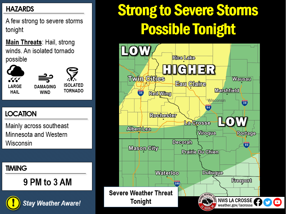
First, tonight, the National Weather Service of La Crosse says scattered thunderstorms could produce damaging winds, large hail and an isolated tornado. La Crosse is right on the edge of the map for high-to-low probability. The warning is between 9 p.m. – 3 a.m.
Along with immediate weather, the NWS had a busy Monday.
First, La Crosse set a new high temp for Sept. 30, at 88 degrees — it happened at 1:53 p.m. at the La Crosse Regional Airport. The old record was 87, set in 1996.
Rochester, Minn., also set a record of 87 degrees. The old record was 86 back in 2002.
The area also hit a tornado record for 2019 at 20. The old record was 18, dating back to 2004. The NWS didn’t say when tornado 19 and 20 occurred. It did say, however, that all the 20 tornado have been EF0 or EF1s. The “Enhanced Fujita (EF) scale” goes from EF0 (weakest) to EF5 (strongest).

Also, the Mississippi River at La Crosse average 7 a.m. September stage was 7.57 feet — the fifth-highest average for the month.

Every month this year has been among the 10 highest, monthly average river stage, including monthly records for April and May.
The NWS also posted rain totals for September with Lancaster, Wis., leading the way.

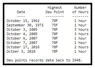
Lastly, dew point talk. The NWS posted, “If you thought that it felt unusually sticky this afternoon, you would be right. Since 1948, there have only been 9 days at La Crosse in which the dew point has reached 70F or higher on or after September 30. This has only happened at Rochester on 5 days. In both locations, dew point records go back to 1948.”


