Minnesota
Minnesota courts release new political district maps

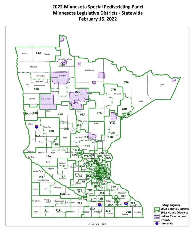
ST. PAUL, Minn. (AP) — A Minnesota panel of five judges released new congressional and legislative district maps on Tuesday, repositioning the state’s political landscape for the next 10 years and setting the stage for November’s midterm elections.
The newly drawn maps showed expansions and contractions of Minnesota’s eight congressional seats, which are currently split between four Republicans and four Democrats. Shifts in legislative districts also raise the stakes for control of a divided Legislature with narrow margins as every seat in both chambers is up for grabs in November.

Minnesota’s 2nd District in Congress, represented by Democratic U.S. Rep. Angie Craig, got smaller and less rural due to increases in suburban population growth over the last decade in the northern part of the district. Despite the shifts in its boundaries, the district appears to remain the most politically competitive statewide as Craig heads for a rematch with 2020 Republican candidate Tyler Kistner.
Hamline University political scientist David Schultz said seven of the eight congressional districts remain similar in their political makeup, but the new 2nd District shedding its more rural areas slightly favors Craig in her run for re-election.
“It pushes a couple of Republican counties out, it moves a new county in and it gives her a little part of Woodbury and that really sort of helps her,” he said.
The 3rd District, which covers the western suburbs of Minneapolis, and the 4th and 5th districts that include St. Paul and Minneapolis, respectively, also shrank geographically as population grew.
The boundaries of the mostly rural 1st District expanded as population growth lagged other parts of the state despite an increase in Rochester, the district’s biggest city.
The 8th District shifted further west and now encompasses all of Minnesota’s Native American reservations north of the Twin Cities. The 7th remains along most of the state’s western border.
Growth in the Twin Cities area and suburbs resulted in more legislative districts in those areas, while stagnant growth outstate meant districts there got larger.
Democratic House Speaker Melissa Hortman, of Brooklyn Park, and GOP Senate Majority Leader Jeremy Miller, of Winona, said it would take time to analyze the newly drawn maps, but Miller said they “appear to be fair.”
A preliminary list from Senate Republicans showed four incumbent pairings of Republican senators that ended up in the same district due to shifted boundaries, two pairings between Democratic senators and one district where a Republican and Democrat were paired. Miller said it’s up to incumbents who get drawn into the same district whether they’ll run again.
“We do not pick winners and losers,” Miller said.
Notable tentative incumbent pairings include Democratic Sen. Ron Latz, of St. Louis Park, and Democratic Senate Minority Leader Melisa López Franzen, of Edina, who is in her first legislative session in leadership, and Sen. Jason Isaacson, of Shoreview, and longtime Sen. John Marty, of Roseville, who is in his 11th term. Also now paired are Republican Sens. Andrew Mathews, of Princeton, and former secretary of state Mary Kiffmeyer, of Big Lake.
Redistricting, or the process of redrawing congressional and legislative district maps, occurs every 10 years when census data is used to edit boundaries to ensure each district has an equal population. The divided Legislature and governor failed to come to terms on new maps before the Tuesday deadline, at which point the job fell to the courts.
Minnesota Supreme Court Chief Justice Lorie Gildea appointed a special panel of five judges in June last year to hear all cases related to redistricting. The panel said in an order that it would attempt to keep communities intact and avoid dividing reservations of Native American tribes more than necessary to meet constitutional requirements.
According to the panel, the ideal population for each of Minnesota’s eight congressional districts is 713,212 residents, 85,172 residents for each of the 67 state Senate districts and 42,586 residents for each of the 134 state House districts.
Minnesota just barely held onto its eight seats in Congress after concerns the state would lose the seat to other faster-growing states in the South and West. Census data released last year showed a shift in urban and suburban population growth in the Twin Cities metro area and away from more rural parts of the state that stagnated or saw declines in population.
Annastacia Belladonna-Carrera, executive director of Common Cause Minnesota, said in a statement that the courts fell short of the panel’s goal to keep communities of color intact within districts, citing splits between House districts for Black immigrant communities in the northern suburbs of the Twin Cities and Latino communities in the southwestern suburbs.
“Minnesotans don’t want Republican or Democratic maps — we want fair maps that give us a voice in our government, regardless of political party, race, or ethnicity,” she said. “These maps rob Minnesotans of color from having a fair say in our government.”
Mohamed Ibrahim is a corps member for the Associated Press/Report for America Statehouse News Initiative. Report for America is a nonprofit national service program that places journalists in local newsrooms to report on undercovered issues.

