
Politics
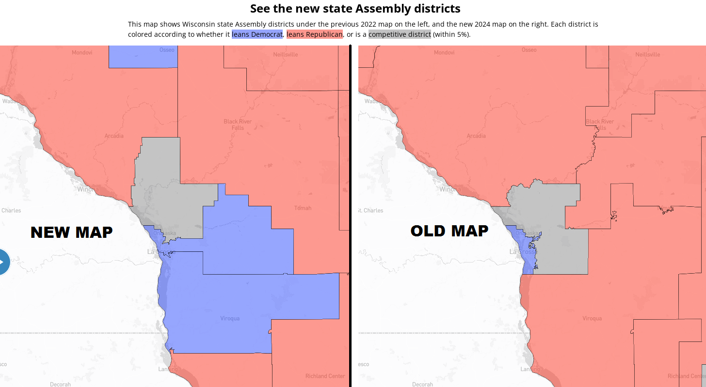
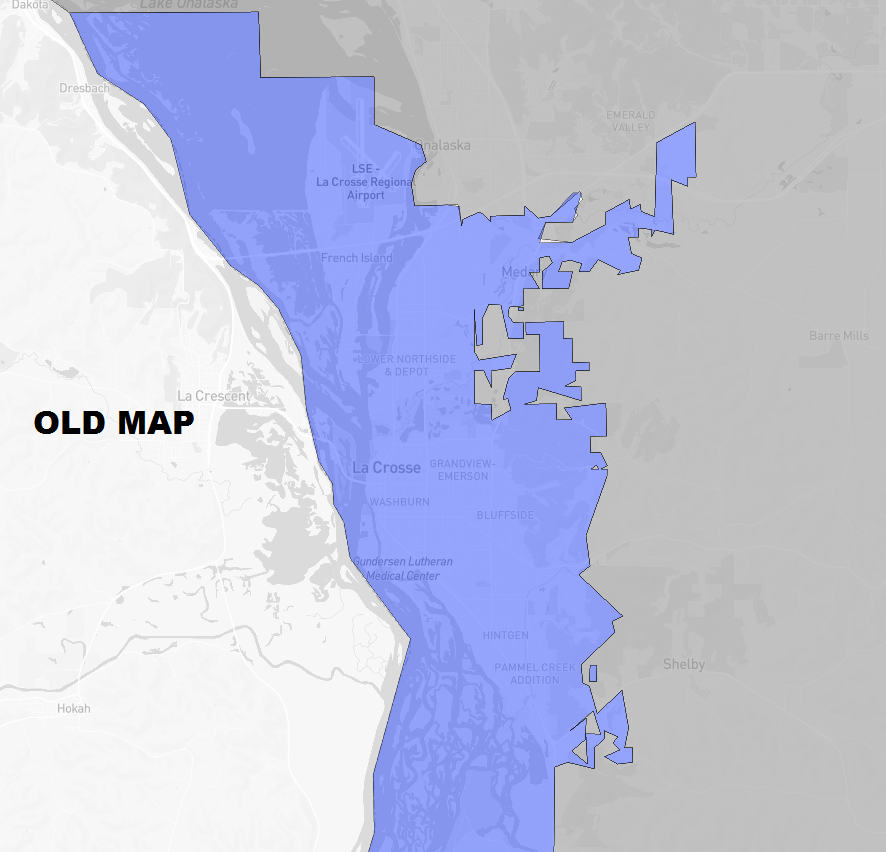
A look at new vs. old Wisconsin Assembly maps in La Crosse, Coulee region
Wisconsin Gov. Tony Evers on Monday signed new voting maps for both the state Assembly and Senate that were passed last week by the Republican-controlled Legislature.
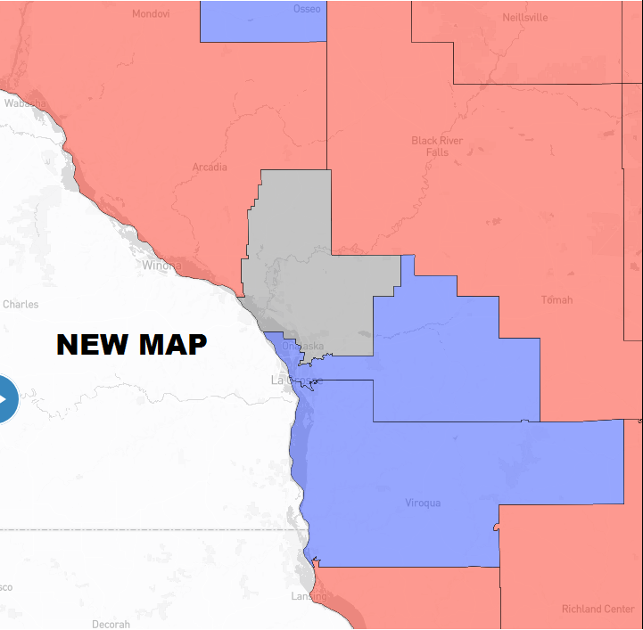
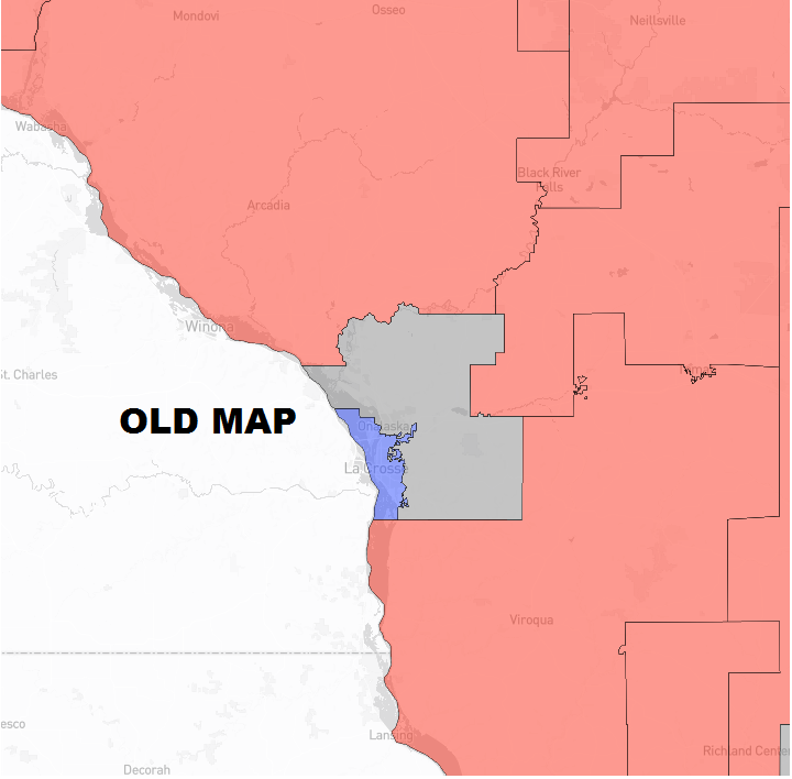
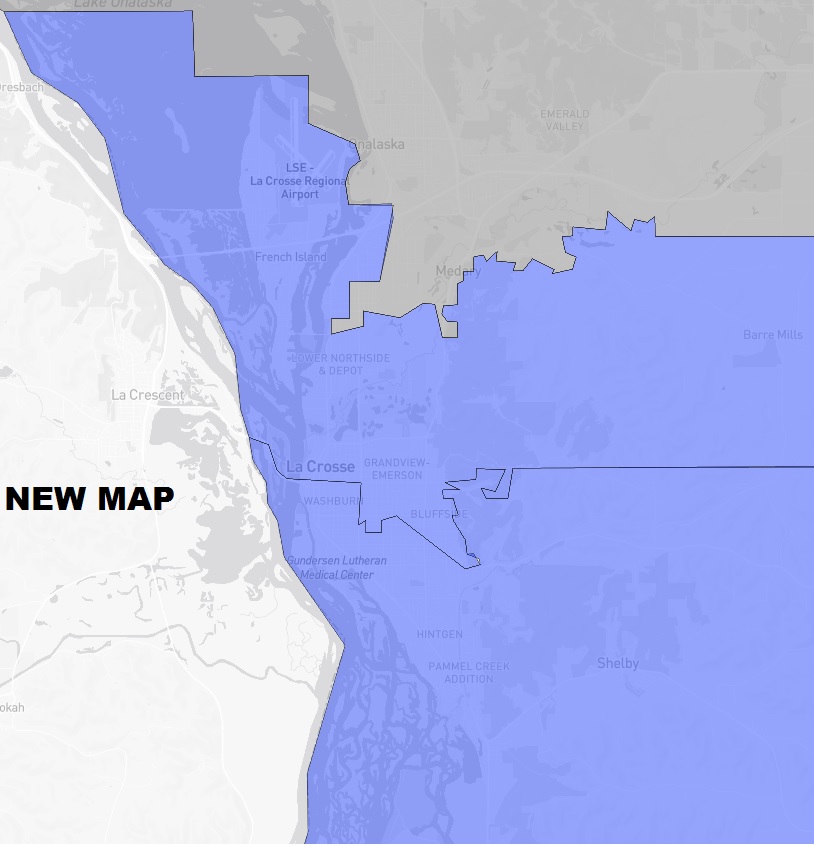
Here’s a look at the new and old Assembly maps for La Crosse and the Coulee Region. The third and forth maps are a closer look at just La Crosse.
To see the Coulee Region state Senate changes, click here.
For a closer look at the new maps, check the Assembly here and the Senate here. For a detailed comparison, check out the Milwaukee Journal Sentinel’s graphic.


Continue Reading
Kent Porter
February 20, 2024 at 6:34 am
HOW CONVIENENT
S H
February 20, 2024 at 3:14 pm
Why divide La Crosse in half and attach land far away? Just drowning out Conservative voices in my opinion. Why add another seat using half of La Crosse? Same reason. It seems to me this is just another gerrymandering tactic to over-correct the old gerrymandered maps. It would really be nice to see, just once, an attempt at fair and honest political representation… is that asking too much in America these days?
If It Looks Like Corruption
February 22, 2024 at 3:30 pm
Clearly, the corrupt Dems are using largely democratic La Crosse to dilute the less populous, more conservative, rural areas, thereby disenfranchising them.
Walden
February 23, 2024 at 1:51 pm
The Wall Street Journal, on Wednesday (2/21), stated “…the Evers map is an audacious gerrymander that heavily favors Democrats.” And “To offset the concentration of Democratic voters in cities like Madison, the new maps distribute urban liberal voters into suburban and exurbin areas.” And further “This is a progressive coup financed by national Democrats led by former Attorney General Eric Holder and implemented by politicians wearing judicial robes.”